… there’s much going on. After the first announcement of the new ingame browser around 2 month ago, I started working in the background to get everything prepared for the new expansion. The last weeks and days before the fanfest were even more work heavier, even during the flight to Island I was still coding to be able to present improved EveMaps version for the Ingame Browser to the devs. During the fanfest itself I was trying to gather more ideas which I could realize.
What did I’ve done in the background, what are the new features:
- Switched live and testing environment to subversion, for better development and code review (even I’m doing everything alone)
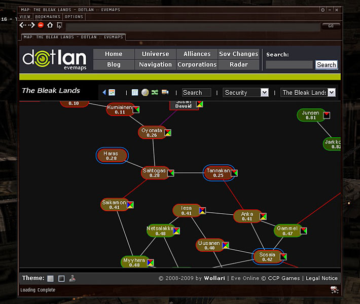
- EveMaps with theme support: light (current), dark (black background), igb (Ingame Browser, optimized for small window sizes)
- Full IGB Browser Support
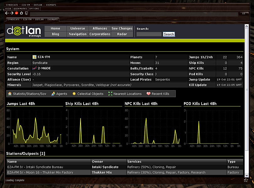
- Regions, Constellation, Alliances, Corps, Stations, Agents, Moons, etc are will show an info
 icon right next to their name when hovering over it.
 - Systems are also get some additional Icons like a link to the Ingame Map, etc.
- Regions, Constellation, Alliances, Corps, Stations, Agents, Moons, etc are will show an info
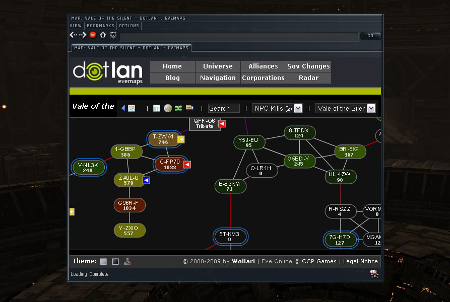
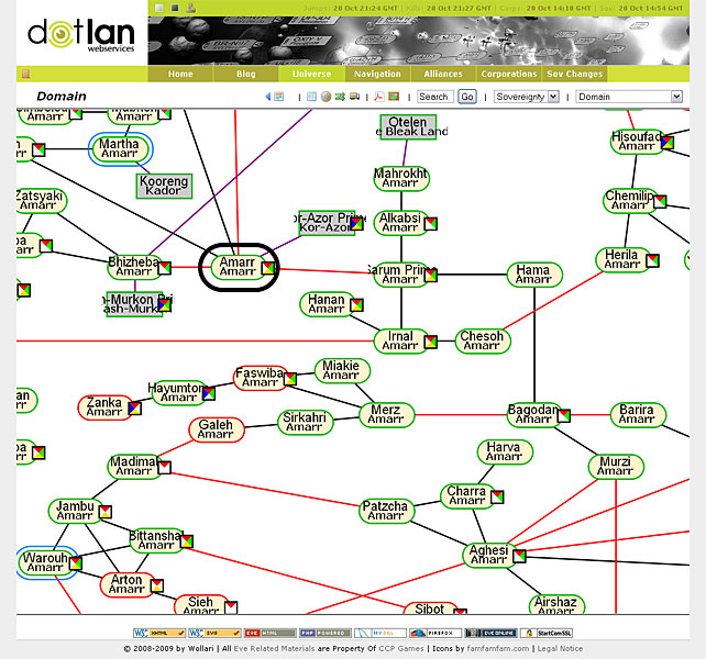
- Zoomable Region Maps
- You can zoom into the normal regional and pan around like google maps.
- Before you ask: No there’s no full zoomable universe map, maybe someday, maybe not.
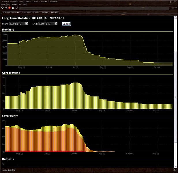
- Long Term Alliances Stats
- You can select a start/end date range and see the history for memberships, corps, systems and outposts. Great, if you want documenting some of the recent failure cascades *hint* 🙂
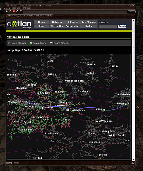
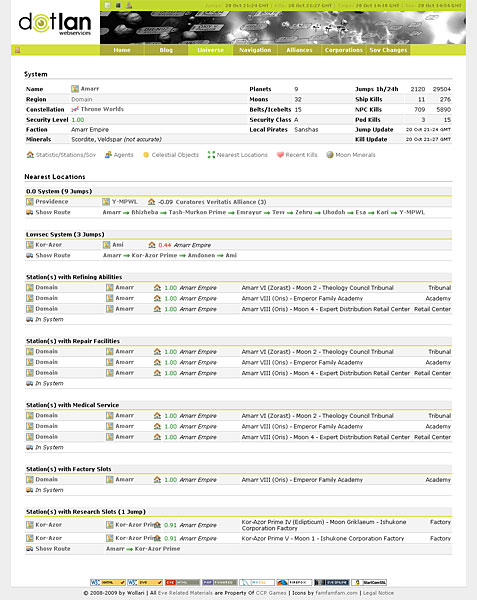
- Nearest Locations (per System)
- In the systems details you’ll find a list which will show you the nearest (in jumps) 0.0/low/highsec system or the next station system with refining/repair/medical/research/factory slots.
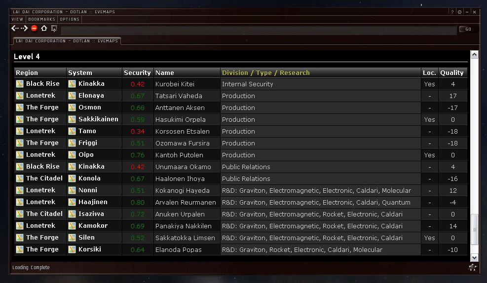
- R&D Agents will show their research services.
Most of the features, which I’ve listed above, are currently tested with Firefox and Chrome. I’ll have to see I can somehow realize some of those functions with the Internet Explorer ….. no comment. Anyway, everything is still in development, needs more testing and tweaking. But basically that’s what you can expect with the Dominion release of EveMaps.
There’ll be more updates coming out for dominion, but atm I’ve to wait until CCP is realising more informations about the sovereignty system, their upgrades and the how everything is integrated and linked with the API.
Fly safe.


Dotlan maps is already amazing and has replaced all my other map tools. The new features are just icing on the cake for me. You rock!
Glad to see this. Once it’s live, I think I will be able to rely nearly exclusively on your maps, even more than I already do…
I can’t wait to be able to use these maps without tanning out of EVE. Thanks for focusing on IGB support! These are my go-to maps these days!
Wollari,
you continue to deliver a top service to the Eve community. Keep up the good work! This website is awesome.
Wollari, you sir are one busy guy! I rely on your maps to provide me some intel that takes a VERY long time to gather any other way. That alone makes this not only the most valuable site I have but the most important. I’ve commented before and will say again, this site is the pinnacle of success IMO. Love the site currently and the changes only look to make your site better than ever!
Awesome-sauce in a bottle mate!!!
Woot I can’t wait for all this stuff to hit the shelves!
So far you’re page works perfectly with Opera. If you are interested in more testing with it mail me.
Suggestions:
1. Allow for modification of the ‘list’ – by adding columns (such as jumps/kills)
2. PDF/Image – should render what is displayed in the browser at the time the button is pressed.
3. Allow for multiple filters to be applied
For example
The Forge
Security
Belts
Jumps/24hours
Displays a map with all four data elements rendered.
Interesting ideas, but I see a few problems.
to 1) Maybe possible if it doesn’t break the layout, but i don’t see that many benift atm.
to 2) Aren’t PDF Maps supposed to print out? The PDF maps are already more detailed (with security level and moon/belt counts) compared to their browser version. And live data (like ship kills are outdated the moment oyou print them out).
to 3) The problem with so much data the ability to read it on the screen. a) each systems can only have one background color b) if you try to to put all that data in the system box itself, you would not be able to read it. It’s just too much! I suppose some kind of overlay popup would be more suited for that, but I’m still unsure if it doesn’t break the clear layout in the end.